Kenai lake enjoying the mountains along the way. Portage pass had lots of
 beautiful mountains. The state of Alaska tunneled through these mountains to make the way easier to get to Whittier and connect them to the rest of the Kenai Peninsula. We stopped at the
  Portage Visitor Center, watched the movie, and enjoyed their displays. Fred’s stomach didn’t allow for us to take the boat ride to
  Portage Glacier, but we did see several
 hanging glaciers from the road to the boat ride.
We made contact with Bonnie and Richard, friends we met at Glacier View CG in BC. They were staying with a friend of theirs, Linda, from Bisbee, AZ. She lives at the community of Indian on the Indian Creek, where it empties into Turnagain Arm. When we passed the turn off to Girdwood the traffic picked up tremendously. Girdwood was having a big celebration for the 4th of July, with a concert at night. We met hundreds of cars before we reached Indian 10 miles way. We pulled in and found their rig. Bonnie contacted their friend Linda. She invited us to park along side Bonnie & Richard and to share supper with them.
 Note the Rhubarb growing to the right of the group. Fred says note the beautiful lady hugging him!
We briefly saw the bore tide coming into Turnagain Arm across the road from Linda’s. We were too far away to get a good shot at it. Supper was wonderful with steaks, sautéed shrimp, corn and we enjoyed the company of all including Linda’s landlords Debbie & Steve. Their hospitality was like the deep south.
Monday, July 4 we celebrated quietly with Bonnie and Richard beside the Turnagain Arm and the busy highway. We played a game of dice and had soup for lunch. We walked up the road to Steve & Debbie’s place enjoying the flowers and strawberries along the way. Steve’s mother still runs Jim’s and
 MaryLou’s so we walked over to see her. She has tables of t-shirts along with a small sample of liquor. She told us of the big earthquake in 1964 and being moved from Portage down this road 25 miles to Indian Creek. They made their living here and their children all had a place to have a home. When Linda arrived home from work we fixed supper together and enjoyed a campfire and smore's.
Tuesday, July 5 was a long fulfilling day. We said goodbye with invites to come visit us to Bonnie, Richard and Linda then headed into Anchorage. They were heading south to the Kenai and fishing while we were undecided about where we would sleep this night. We stopped in Anchorage for some more books and looked for a special t-shirt for Fred, then headed on. A stop at the visitor center near Palmer told us the weather was good to head toward Denali. Hopefully we would get to see it.
 Denali, there it was peaking out from behind the trees. We kept getting glimpses until we stopped at a roadside park designated a viewing site. By then a little cloud came in front of it and everyone, including us just sat and waited for the cloud to go away.
 The
The cloud never went away totally, but that was ok, we could see the peak. For those that haven’t been here this peak is 20,320’ tall! The others around it are over 12, 000. That’s as tall as Long’s peak in Colorado.
This peak is actually officially called McKinley. The native Indians called it Denali or “high one.” Then in 1896 it was renamed McKinley after the Presidential candidate. The US board of Geographic names dictates that no living person can be commemorated. It was not until President McKinley’s assassination in 1901 that the name change became valid. Many Alaskans and mountain climbers have repeatedly lobbied to have the name changed back to Denali. In 1975, the Alaska legislature made an official request. The request has never been accepted because Congress always has pending legislation to keep the name.
In 2001, the Alaska Historical Commission committed to change both Denali and Foraker back to their original names. The US Board of Names usually gives preference to local usage, but will not take issue with Congress. Policy dictates that name changes cannot be made if there is pending legislation. As long as the congressman from McKinney’s old district in Ohio continues to make sure there is pending legislation this stalemate will continue.
Whatever the official name, we call it Denali and it is beautiful.
After having that 30% chance to see this mountain, we decided to go back south to head home.
Now don’t get excited. It has taken us 3.5 months to get here, it may take us that long to get home. We have targeted October 1 and hopefully we will make it for Waxahachie’s homecoming and Olivia’s 50 year reunion.
On the drive north we crossed the
 Susitna River and saw people down on the bank. We decided to head back to that spot later to spend the night. When we parked it was after 5:00 pm and we were hot and tired. Yes , hot it was 71 degrees today and felt hot compared to what we have had weather-wise. Shortly after parking and opening the windows a nice breeze sprang up and it was delightful.
Before we went to bed we heard an airplane noise and sure enough it was right beside us ready to  take off on the gravel river bed near us. What an adventure!
We received an email from a friend we met in Wisconsin last year. He had showed us slides of their trips to Alaska. One of them was where they camped on the Chena River out of Fairbanks. We had been thinking of them when we pulled into this spot.
He said, “I am truly glad to hear that you are enjoying your Alaska adventure. I feel sorry for people who could but would never venture past the county line, or the people who cannot find any beauty in the world like the ones who can't see the forest for the trees. We wish the best possible travels for you and know you will continue to find the beauty of Alaska.”
We feel the same sympathy for those who won’t or can’t take off like we are doing. God has made a beautiful world and if you don’t live in one of those places, then get up and GO!
Wednesday, June 6, we enjoyed our river spot then headed to see Talkeetna. We drove into town, through it, and turned around all the time hunting for a place to park. Then we were out of it. The stores, shops, and way-stations looked interesting, but we didn’t get to see them.
As we left we stopped south of town at a pullout and were among many taking pictures
 of Denali. It was a clear day and we enjoyed seeing it again. The mountain on the left is Mt Foraker or Denali Be’of “wife of hi one,” at 17,400 and the one in the middle is Mt Hunter or Begguya, “child” at 14,573.
So many people don’t get to see these peaks after driving this far and here we saw them twice. When visible, it mesmerizes. It draws a crowd. Crowds are more intent than bear-jam fanatics.
We pulled into civilization again at Wasilla and found a place to stay for the night at Matanuska Valley state recreation area. We went to the farmer’s market and saw lots of huge squash and zucchini. Then drove to a
 U-Pick farm. Unfortunately they were not ready to sell. Give them a couple of weeks. This farm started as a LLD farm to feed the poor, but was sold out to individuals about 30 years ago. Everything looked so inviting and the soil was so rich, with mountains looming over the fields. Wow!
Thursday, July 7 we headed east through a beautiful drive along the Matanuska River. The road twisted around
  mountains and over hills.
Before we knew it we had found our home and it was only 12:30 so we had a long afternoon with nothing to do. We were parked on a big cleared area where hunters and ATV’s park to enjoy the country to the north. The trail leads over the hills behind us. The best part about this spot was the view across the road to the south. We could see the
 Chugach Mountains. Nelchina Glacier winds downward through a cleft in the mountains. We were on Eureka Summit, a divide separating three major river systems: Susitna, Matanuska and Copper.
Friday, July 8, Olivia woke up at 5 am and it was raining and it continued until 7. Since we were parked on a cleared land, it was very muddy. We knew it would be bad getting the jacks up and ready to roll. The sky was completely overcast and we could not see the pretty mountains. We were blessed to see them the day before.
As we set out we were in the midst of a
 400 mile bicycle race. We didn’t envy them, not only because of the miles, but it was 50 degrees, raining and windy.
As the day wore on, the sun tried to come out and puffy clouds were in the sky and we’re sure that made it bicyclists happy.
Even though we had miserable morning weather, we are adjusting to dry camping. Having the generator has allowed us to charge the computer and lets Olivia blow her hair among other things like Fred’s razor, drill, & microwave. Along with the air card it is almost like having power. Plus, most of the time it is a free night.
Later we stopped for the night at Tolsana Wilderness Campground which was a big improvement from the mud of the morning. It was wooded, with a pretty little
 stream running though it and was also a Passport America spot with Wi-Fi at the spot.
Sounds like a contradiction from what we said about our previous spot doesn’t it. Well, we are flexible!
We drove into Glennallen for cappucino then back to the Tolsana Lake lodge for a mid day meal of shrimp, cod and calamari. As we were leaving Fred mused at the biplanes parked in the houses back yard.
Saturday July 9, we set out for a day trip to Valdez passing the Wrangle Mountains visible for a long way down the Richardson Highway along with the
  fireweed.
On a short loop detour we enjoyed seeing the
 Copper Center City Hall. We thought of Dr. Jon, not only for the "John," but this is Copper River country and he loves it’s salmon.
In 1899, Chief Nicoli of the lower Copper river people, directed prospectors to copper deposits in the Chitina River valley. This set off a copper rush. Between 1911 and 1938, 4.6 tons of the highest-grade commercial copper deposit ever found were processed out of this area.
The Copper River is 290 miles long and is the single largest source of fresh water to the Gulf of Alaska. It’s delta is the largest contiguous wetland on the Pacific Coast,
All along this highway we saw
 bicycles riding to Valdez on their 400 mile ride. We saw them going and coming.
We started getting glimpses of the  Alyeska Pipeline. Built between 1975 and 77 it employed over 30,000 workers and was the largest, most expensive privately funded construction project ever undertaken.
It is owned by Alyeska Pipeline Service Company a consortium of oil companies including BP, ConocoPhillips, Exxon/Mobil, Unocal and Koch Alaska.
 holding this 48” diameter pipeline which winds through 3 major mountain ranges and terminates in Valdez.
The pipeline is 800 miles long and sends 1.5 million barrels a day through the 48” diameter.
Where permafrost-permanently frozen soil– is present, and heat from the pipeline might thaw unstable soils, the line is insulated and elevated. The insulated pipe is mounted on Teflon-coated shoe assemblies, designed to slide on crossbeams installed between vertical supports.
These supports are located about every 60 feet. The zig-zag design of the line provides the flexibility necessary to accommodate movements due to temperature changes.
In areas where the frozen-soil temperatures are near the thaw point,
 heat pipes are installed inside the pipeline’s vertical supports. The finned radiators above the supports are the external extensions of these heat pipes, which employ a fluid with a low boiling point to take heat from the ground through vaporization and condensation. Heat from the soil enters the lower end of a sealed tube, causing the fluid inside to boil. The resulting vapor rises to the radiator and condenses, releasing energy.
Ahead lay
 Mount Billy Mitchell, which brought back memories to Olivia as her daddy, Cecil, was on the ship Billy Mitchell when he came home from Europe after WWII. Billy Mitchell was in the signal corps completing the trans-Alaska telegraph line to connect all the military posts in Alaska. He was later to become the “prophet of American military air power” with his idea that “He who holds Alaska will hold the world as far as defending the North American continent.”
Later we crossed the
 Tsaina River at the Devil’s elbow with deep gorges to both sides of the bridge and pretty mountains in the background. Here we also entered BLM land with a sign stating sustenance hunting was allowed.
Bicyclists showed up again and again, this time as we neared
 Worthington glacier. The clouds were
 rolling over the top like an avalanche.
Around the corner Fred named this glacier
 Beverly glacier after our friend Beverly Worthington.
As we crested the top of
Thompson pass we could see all the way
 to the valley of Valdez and the
We detoured into a nice little road to see Blueberry Lake Recreation site and watched a man fly fishing from an inner tube float. Tucked in between tall mountain peaks, this is one of Alaska’s most beautifully situated campgrounds.
Entering Keystone Canyon we saw a long tunnel from the old road visible beside the new highway. “On the far side, just above the water were remains of the old sled trail used in the early days. It was cut out of the rock, just wide enough for 2 horses abreast. Above it was the old goat trail, used until 1945.”
Around another turn we saw
 Bridal Veil and
 Horsetail falls. While stopped to take pictures of the falls, Olivia witnessed a weird sight. We know bees and butterflies pollinate flowers but have never heard of
  flies doing this. All of the cow parsnips had hundreds of flies on the flowers.
As we neared Valdez, we turned onto Dayville road recommended to be an option for RVers who like to stick close to their RV but still see wild Alaska. We could see the back side of the harbor with  fishing boats in the bay.
In Prince William Sound over 20 glaciers terminate at sea level; numerous others cling to steep mountainsides. There are hundreds of bays, fjords and islands with over 3,000 miles of shoreline.
People were wade
 fishing all along, under the mountains.
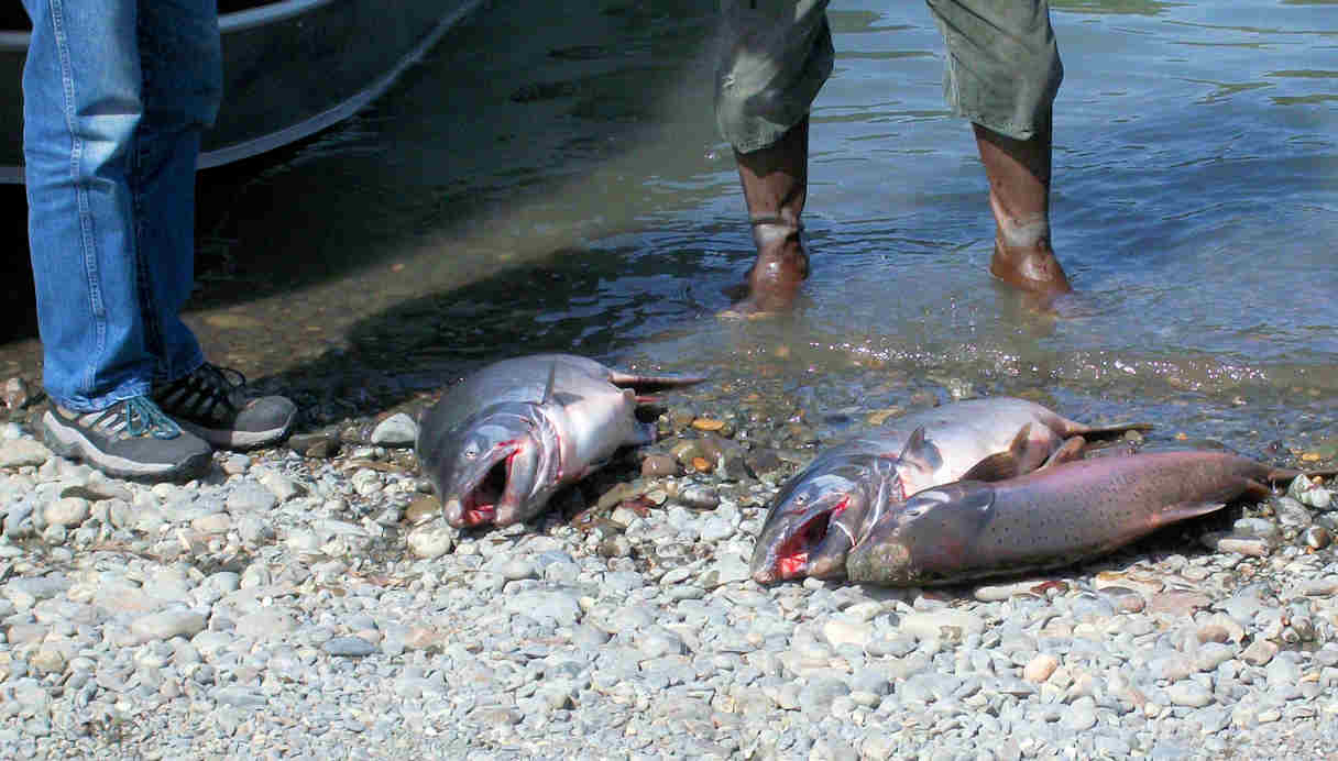
At the fish hatchery we saw some of the pink salmon
attempting to go up the little stream instead of being diverted into the hatchery. Sea gulls and eagles were waiting to have dinner along with the
 anglers.
The  fireweed also thrived along the bay of Valdez.
As we watched these  fishermen one lady squealed, “I caught one!.” After landing it and casting again, she squealed again, “I caught another one.” We believe she got her money’s worth for the whole day. The other anglers were not as lucky.
At the end of Dayville road was one of many  campgrounds along the road and a guardhouse restricting public access to the Alyeska Pipeline Terminal complex as there was NO public access to the marine terminal and NO public tours.
The campgrounds are $12 for overnight, $3 day use. There was a wonderful array of wild life viewing opportunities steps away. We saw seals among the fishermen and were told bears were known to frequent this area, along with fish, otters, and birds.
Driving to the other side of the bay and into the town of Valdez we could see the
 terminus at the bottom of the mountains and next to the water. The oil is fed by gravity into tanks or directly into waiting oil tankers at the terminal. We didn’t spot any large ships loading.
We did see the fishing boat  Gladiator out of Seattle at the city dock.
We spent a little time in the city and ate at the Hamburger joint across from the Halibut House. Both had been recommended and now we can recommend the hamburger house for it’s Halibut fish and chips. Delish! As you can see Fred is cramming all the fish eating into our last few days in Alaska. We declared this was the best of the best.
Valdez was not what either of us expected, but there again we didn’t really know what to expect. It is on the back end of a beautiful fjord. So did we evidence of the Exxon Valdez oil spill? None what-so-ever. We did see evidence of wealth around the city. This town has benefitted many relatively high paying oil related jobs and from a lot of Exxon settlement money.
On the way back over the pass we kept seeing
 bicycler’s laboring over the big climb. Too bad they weren’t looking at the
 scenery.
This road is the southern part of the Richardson highway. We witness the last 75 miles were in the mountains. Not on the peaks, we were in the valleys where we could see mountains on both sides of us.
Olivia decided this drive was pretty, no beautiful, no gorgeous! Of all the roads we have driven in Alaska, three top our list for scenery.
The drive to Skagway was dramatic in it’s beauty.
The ”Top of the World” was the most spacious in it’s beauty.
The road to Valdez was simply just beautiful. They are all favorites in their own way.
We recommend these roads as a MUST if you are planning a trip to Alaska.
The
 fireweed is among the prettiest of the wildflowers in the north country. We have enjoyed it every time we go north of the 45th parallel. The story is when it quits blooming winter is six weeks away.
We hope you were able to download all the pictures.
We love to hear from you, so email us at
Olivia@bobheck.com or Fredharrington@yahoo.com